© Shipping Wonders of the World 2012-


Part 38
Part 38 of Shipping Wonders of the World was published on Tuesday 27th October 1936.
It included a centre photogravure supplement featuring the Navies belonging to the British Commonwealth of Nations, which formed part of an article called Navies of the Dominions.
The Cover
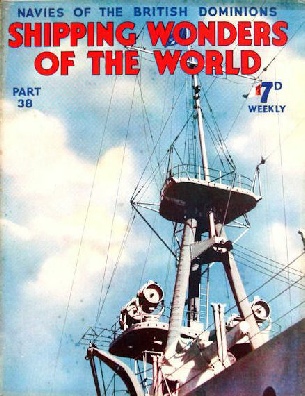
This week’s cover shows an American ship fitted with four Sperry 36-in high-intensity searchlights. Each has a beam candlepower of 387,000,000. Given normal visibility, such a searchlight would pick up clearly a small boat on the horizon 17 to 20 miles away. For the photograph on which the cover is based I am indebted to the Sperry Gyroscope Company, Limited, and to R I Nesmith and Associates, of New York.
Contents of Part 38
Trap Ships of the Fishing Fleet
Concluding section of this article from part 37. This part includes the tale of the Ethel and Millie, one of the most moving and inspiring of all the “Mystery Ship” stories.
The Congo: Central Africa’s Highway
The River Congo and its numerous tributaries form the only means of transport through thousands of miles of central Africa. Where navigation is obstructed by rapids and gorges, railways connect the navigable sections of the river. Sir Henry Stanley is famous as the originator of a phrase that has gone down in history - “Doctor Livingstone, I presume?” His discovery of the lone pioneer and missionary is one of the most extraordinary in the history of exploration. But Stanley deserves recognition for greater achievements than the mere coining of a phrase. It was he who, when Africa was really “the Dark Continent”, took his life in his hands to explore the River Congo. This chapter tells the story of the exploration of the Congo by Stanley and by the men who came after him. This is the fourteenth article in the series on World Waterways.
Navies of the Dominions
The Navies belonging to the British Commonwealth of Nations are administered in peace time by the separate Dominions. If they were put at the disposal of Great Britain in the event of war, they would become an integral part of the Royal Navy. A Maori chief once presented Captain Green of the New Zealand Division of the Navy with an apron for which magic powers were claimed. It was said that the wearer of the apron would go unharmed in battle. At the battle of Jutland, Captain Green was in command of HMS New Zealand and, remembering the superstition, he put the apron on. The strange fact is that the New Zealand came under heavy fire on several occasions but escaped without any serious damage, and was the only one of Beatty’s ships which had no casualties. Whether or not the apron was really an effective shield from the guns of the enemy is a matter of debate. However that may be, the British Empire cannot with safety put its in “black magic”. Naval power is more likely to be a deterrent to an aggressor, and the various navies of the Dominions all play their part in upholding the prestige of the Empire. This chapter provides a full account of the Navies of the British Dominions - Navies which though young have absorbed the traditions that have existed in the Senior Service since the time of Drake. This is the tenth article in the series The Navy Goes to Work.
Navies of the Dominions (photogravure supplement)
In Lyttelton Harbour
IN LYTTELTON HARBOUR, New Zealand, HMS Diomede is berthed near the Rangatira, a vessel which plies between Lyttelton, South Island, and Wellington, North Island. The Diomede was completed in 1922, and two years later was transferred to the New Zealand Division with her sister ship the Dunedin. A cruiser of 4,850 tons displacement, the Diomede has a length of
472 ft 6 in, a beam of 46 ft 6 in and a mean draught of 14 ft 3 in. A turret and forward gunhouse are among her chief characteristics. The Rangatira, 6,152 tons gross, has a length of 405 ft 1 in, a beam of 58 ft 2 in and a depth of 25 ft 9 in. She belongs to the Union Steamship Company of New Zealand.
Navigational Charts
An immense amount of careful and skilled work goes into the making and revising of the various types of charts upon which mariners depend. In the year AD 150 the cartographer Ptolemy drew a map of the world which for fourteen hundred years was regarded as the standard authority. A reproduction of Ptolemy’s map appeared in the first part of Shipping Wonders of the World. For more than a thousand years the art of charting and mapping stood still - or perhaps I should say it went back, for some of the productions of the Middle Ages were far less accurate than Ptolemy’s map. In the sixteenth century Gerard Mercator invented his system of projection, which is still used to-day. Mercator’s projection overcame one of the greatest difficulties of early cartographers - that of presenting the earth’s curved surface on a flat piece of paper or vellum. Nowadays the charting of coast-lines and of the ocean bed is a specialized science. This chapter gives a brief note on the historical aspect of the subject, describes the methods by which surveying ships do their work, and gives an account of the Admiralty charts. The chapter is illustrated with a simplified reproduction of a portion of one of these charts and, with the aid of this, the author conducts the reader on an imaginary voyage from Dover to Dunkirk showing how reference to the chart enables the mariner to circumvent the various shoals and sandbanks.
Norway to New Zealand in a Cutter
Accompanied by his wife and later by his young son and a dog, Erling Tambs sailed a 40-feet cutter, the Teddy, from Norway to New Zealand where his daughter was born. Erling Tambs, a Norwegian poet, refused to be circumscribed by the limits of a conventional existence. His wife, fortunately, was of a similar mind, and together they sailed off in a small yacht. After many adventures, disaster finally overtook the cutter, but the whole family was saved. This chapter begins their story, which is concluded in part 39. It is the eighth article in the series Great Voyages in Little Ships.
Navies of the Dominions - Photogravure Supplement
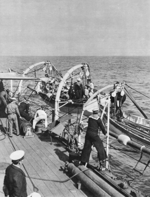
AWAY SEA-BOAT! A boat being slipped from the falls during manoeuvres of the South African Squadron. A naval base and a dockyard of considerable importance are maintained by the Union of South Africa at Simonstown, near Capetown. The South African Naval Service, however, was disbanded in 1934 when the minesweeping vessels Immortelle and Sonneblom, now Eden and Foyle, were returned to the Royal Navy. The South African Squadron of the Royal Navy is based at Simonstown.
.